A Google Earth Tour of Ancient and Modern Jericho
https://earth.google.com/web/search/ancient+Jericho
Attached to this post are several reference maps I've created using Google Earth to demonstrate what could be used by a teacher to illustrate a "Jericho Talk" using a computer connected to the internet.
Jericho Notes:
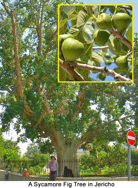
Modern Jericho is much bigger than it was in Zaccheus' day, in part due to modern agricultural methods and the presence of Palestinian refugee camps on its borders. As you can see by the linked Google map and images below, Jericho in the time of Zaccheus and Jesus was also much bigger than it was in the Old Testament time of Joshua (circa 1400 B.C.). That means "ancient" Jericho was already in ruins when Jesus and Zaccheus would have seen it. Read more about Jericho in our Zaccheus Bible Background.
Things to look for on the Google Earth map:
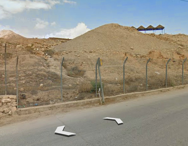
Look for "Tel Jericho" the brown hills at the southern tip of the Ein Al Sutan refugee camp marked on Google Earth. "Tel" is the Hebrew word for "mound or hill." (In Arabic it is spelled "Tal.") For reference, look at the map marker for the cable car tourist attraction which goes over the ruins. Click the "street view" icon and click the road that goes by the ruins to see what the ruins of Jericho look like today (also pictured below). Question: What "lesson" or meaning do you think Jesus and Zaccheus would have taken away from a visit to these ruins?
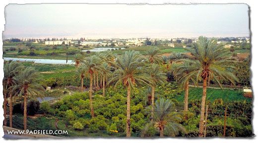
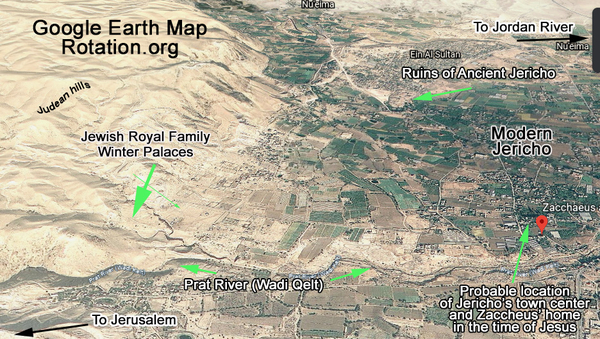
Look for the "Wadi Kelt" (also spelled "Qelt") and otherwise known as the River Prat which comes out of the Judean highlands and crosses Jericho. This area of Jericho is the historic agricultural part of Jericho and the town center. Many springs dot the area. It is very likely that wealthy Zaccheus lived in this "green" area. The Jewish royal family had winter palaces up in the hills above the Wadi. By the time of Jesus, the Romans had appointed a governor to rule the region around Jerusalem. One of them was named Pilate, and it is very likely Zaccheus—who also worked for the Romans—had met him. Question: How do you think Zaccheus reacted to news of Jesus' death at the hands of his boss, Pontius Pilate?
The city's "center" moved throughout history. The ruins of Joshua's Jericho (circa 1400 BC) are north of today's city center. Over time, the center moved south along the Wadi Kelt/Prat River, between the Hasmonean Palaces at the entrance to the highlands and the fields east along the river. Tradition places Zaccheus' Jericho along this river.
Look for the site of Jesus Baptism on the Jordan River. Notice how close it is to Jericho. Read Luke 3:1-22 which describes John baptizing people there, including tax collectors and Jesus! Question: Zaccheus had no doubt heard about John baptizing Jews (including tax collectors) in the Jordan River. Do you think Zaccheus was one of them? Why or why not?
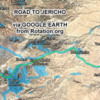
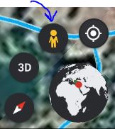
Zoom out and look at various points along the Road to Jericho/Jerusalem. Click the "person walking" icon to highlight the road, then click points on the road to go to the "Road View" for close-up views of what the journey looks like today. This was the road Jesus walked after vising with Zaccheus, and the dangerous road on which the parable of the "Good Samaritan" is set. Question: How many people do you think Jesus encountered along this road and what do you think he might have said to them? What road in your area would you be most likely to encounter Jesus walking today?
Click to enlarge:
Overview:
Above: Tel Jericho, the ruins of "ancient" Jericho from Joshua's time.
Where to find the "street view" icon on Google Earth:
The road between Jerusalem and Jericho.

Photo of Road to Jericho from another source (there are many online):
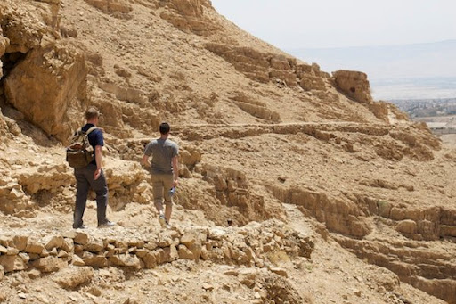
Jericho is known as an oasis in the Judean wilderness fed by many springs and winter runoff from the highlands. It hosted the winter palaces of Hasmoneans -- the royal family of King Herod.
